Dynamic of the Land Use and Land Cover Change in Banyuwangi Regency From 1995-2019

Isi Artikel Utama

Nurlita Indah Wahyuni Nurlita
Abdul Wahid Hasyim Hasyim
Soemarmo Soemarmo Soemarmo

Abstrak

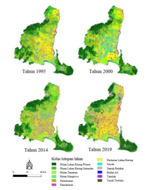
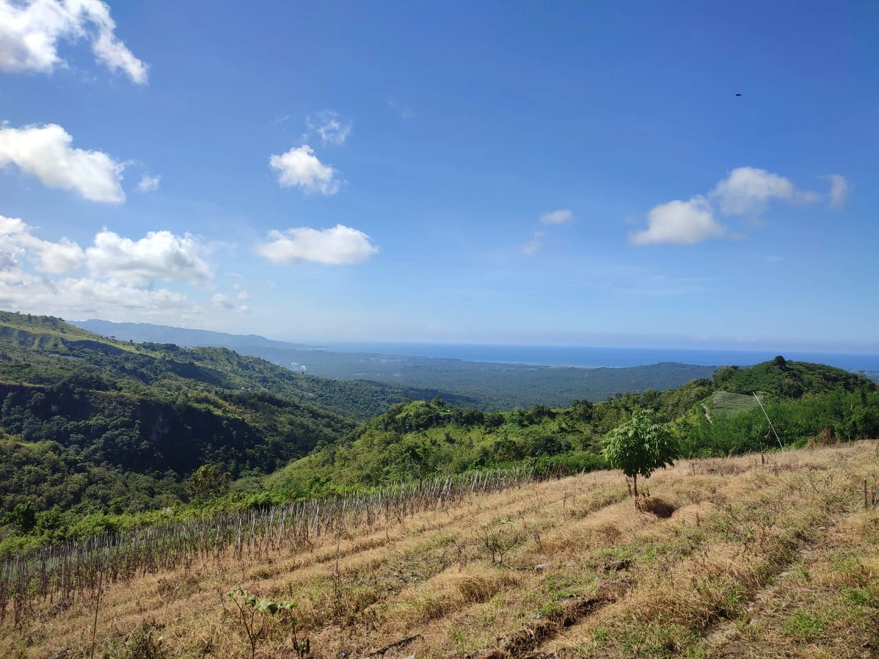
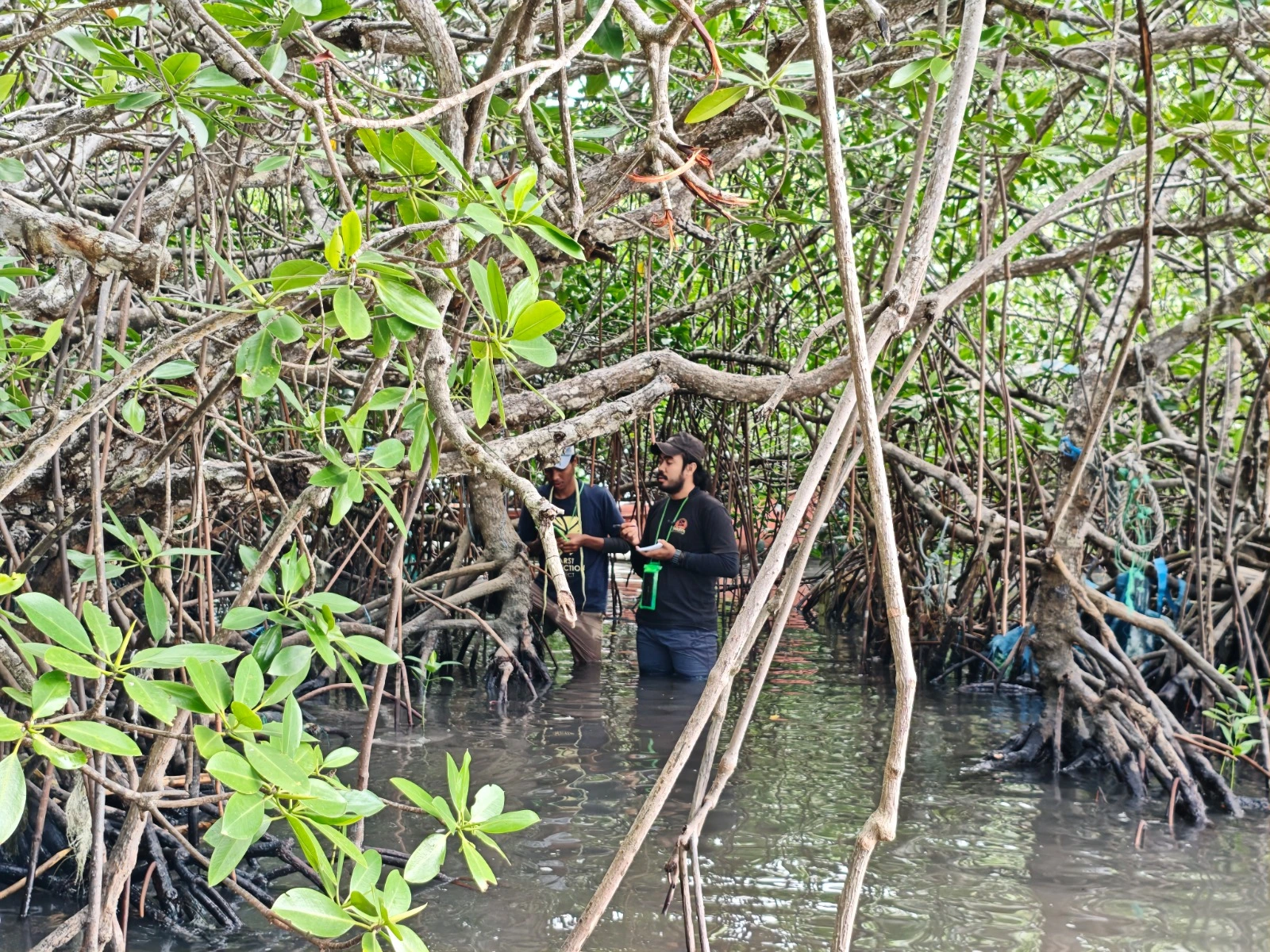
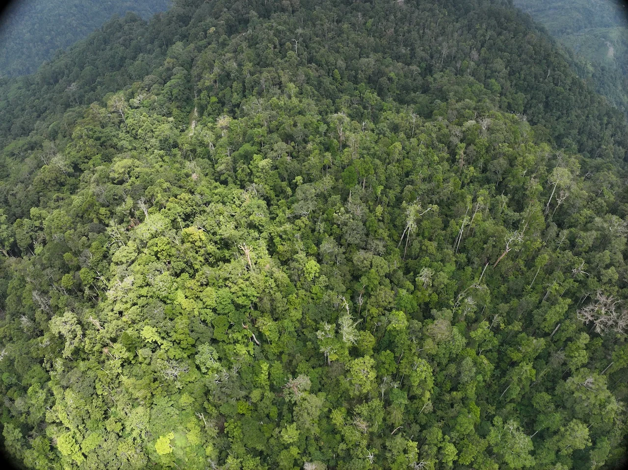
The land use and land cover change phenomenon has become one concern over many regions worldwide, including Indonesia. Land use and land cover change due to human activities triggered alteration terrestrial ecosystems and its services including climate control functions. The study aimed to analyze land use and land cover change in Banyuwangi regency during 1995 – 2019. Four satellite images from acquisition year 1995, 2000, 2014 and 2019 were used to analyze the spatial and temporal changes along with field observations. The classification processes of land use and land cover included determination of training areas, supervised classification, and accuracy assessment. There are 12 land use and land cover based on supervised classification as follow primary forest, secondary forest, plantation forest, mangrove forest, plantation, settlement, cropland, paddy field, shrubs, water, fishpond and barren land. The result showed during observation period of 1995 until 2019 land use and land cover which tends to decrease are secondary forest, mangrove forest, and rice fields. On the other hand, the area of settlements, shrubs and fishponds were increased significantly.

Rincian Artikel

Nurlita , N. I. W., Hasyim, A. W. H., & Soemarmo , S. S. (2021). Dynamic of the Land Use and Land Cover Change in Banyuwangi Regency From 1995-2019. Jurnal Wasian, 8(2), 121-132. https://doi.org/10.62142/2vab3c95
Articles

Arifin, S., Annas, A., Sari, N. M., & Kushardono, D. (2015). Identifikasi dan interpretasi visual citra kamera digital multispektral untuk objek wilayah pesisir. dalam Sambodo, K. A. Kartasasmita, M. Hasyim, B. Kushardono, D. Adiningsih, E. S. Asriningrum, W. Dewanti, R. & Harsanugraha W. K. (Eds.), Seminar Nasional Penginderaan Jauh, (p.560–566). Bogor: Lembaga Penerbangan dan Antariksa Nasional.

Aslan, A., Rahman, A. F., Robeson, S. M., & Ilman, M. (2021). Land-use dynamics associated with mangrove deforestation for aquaculture and the subsequent abandonment of ponds. Science of The Total Environment, 791: 1-12, 2021148320. Available from: https://doi.org/10.1016/j.scitotenv.2021.148320

Azadi, H., Keramati, P., Taheri, F., Rafiaani, P., Teklemariam, D., Gebrehiwot, K., Hosseininia, G., Van Passel, S., Lebailly, P., & Witlox, F. (2018). Agricultural land conversion: Reviewing drought impacts and coping strategies. International Journal of Disaster Risk Reduction, 31, 184–195.

Badan Pusat Statistik Kabupaten Banyuwangi. (2020). Kabupaten Banyuwangi Dalam Angka 2020. Banyuwangi: BPS Kabupaten Banyuwangi.

Badan Standardisasi Nasional Indonesia. (2014). Klasifikasi penutup lahan - Bagian 1 : Skala kecil dan menengah (SNI 7645-1:2014). pp. i–51.

Boori, M. S., Vozˇenı´lek, V., & Choudhary, K. (2015). Land use/cover disturbance due to tourism in Jesenı ´ ky Mountain, Czech Republic : A remote sensing and GIS based approach. The Egyptian Journal of Remote Sensing and Space Sciences, 18, 17–26.

Buwono, Y. R., Ardhana, I. P. ., & Sudarma, M. (2015). Potensi fauna akuatik ekosistem hutan mangrove di kawasan Teluk Pangpang Kabupaten Banyuwangi. ECOTROPHIC : Jurnal Ilmu Lingkungan (Journal of Environmental Science), 9(2), 28-33.

Cheolmin, Kim. (2016). Land use classification and land use change analysis using satellite images in Lombok Island , Indonesia. Forest Science and Technology ISSN:, 12(4), 183–191. https://doi.org/10.1080/21580103.2016.1147498

Dewa, D. D., & Sejati, A. W. (2019). Pengaruh perubahan tutupan lahan terhadap emisi GRK pada wilayah cepat tumbuh di Kota Semarang. Jurnal Penginderaan Jauh Indonesia, 01(01), 24–31.

Dwiprabowo, H., Djaenuddin, D., Alviya, I., & Wicaksono, D. (2014). Dinamika Tutupan Lahan: Pengaruh Faktor Sosial Ekonomi. Yogyakarta: Penerbit PT Kanisius.

Hakim, L., Pamungkas, N. R., Wicaksono, K. P., & Soemarno. (2018). The conservation of osingnese traditional home garden agroforestry in Banyuwangi, East Java, Indonesia. Journal of Agricultural Science, 40(3), 506–514.

http://doi.org/10.17503/agrivita.v40i3.1605

Hamilton, S. (2013). Assessing the role of commercial aquaculture in displacing mangrove forest. Bulletin of Marine Science, 89(2), 585-601. http://dx.doi.org/10.5343/bms.2012.1069.

Hapsari, K. C. P., & Dinda Ayu Permatasari. (2020). Changes of mangrove area in Pangpang Bay, Banyuwangi 2014-2018 using Landsat-8 imagery. Journal of Physics: Conference Series 4th International Seminar on Sensors, Instrumentation, Measurement and Metrology, 1-6

Hapsari, L., Basith, A., & Novitasiah, H. R. (2014). Inventory of invasive plant species along the corridor of Kawah Ijen Nature Tourism Park, Banyuwangi, East Java. Journal of Indonesian Tourism and Development Studies, 2(1), 1–9.

Harini, R., Yunus, H. S., & Hartono, S. (2012). Agricultural land conversion: determinants and impact for food sufficiency in Sleman Regency. Indonesian Journal of Geography, 44(2), 120-133.

Herbeck, L. S., Krumme, U., Andersen, T. J., & Jennerjahn, T. C. (2020). Decadal trends in mangrove and pond aquaculture cover on Hainan (China) since 1966: mangrove loss, fragmentation and associated biogeochemical changes. Estuarine, Coastal and Shelf Science, 233, 1–13. https://doi.org/10.1016/j.ecss.2019.106531

Jamilah, J., Ismail, M., & Syarif, E. (2020). Gold mining related conflict in Tumpang Pitu Banyuwangi East Java. dalam Hariguna, T. & Shih Chih Chen (Eds.), The 1st International Conference on Recent Innovations (pp. 1643–1650). Jakarta: SCITEPRESS-Science and Technology Publications, Lda.

Jumaedi, S. (2016). Nilai manfaat hutan mangrove dan faktor-faktor penyebab konversi zona sabuk hijau (Greenbelt) menjadi tambak di wilayah pesisir Kota Singkawang Kalimantan Barat. Jurnal Sosiohumaniora, 18(3), 227-234 https://doi.org/10.24198/sosiohumaniora.v18i3.10104

Junaidi, M. (2016). Faktor-faktor yang menyebabkan alih fungsi lahan dari tambak menjadi perumahan di Kelurahan Wonorejo Kecamatan Rungkut Kota Surabaya Abstrak. Jurnal Pendidikan Geografi, 3(3), 378–383.

Kementerian Lingkungan Hidup dan Kehutanan. (2020). Rekalkulasi Penutupan Lahan Indonesia Tahun 2019. Direkorat Inventarisasi dan Pemantauan Sumber Daya Hutan. Direktorat Jenderal Planologi Kehutanan dan Tata Lingkungan. Jakarta: Kementerian Lingkungan Hidup dan Kehutanan.

Khatami, R., Mountrakis, G., & Stehman, S. V. (2016). A meta-analysis of remote sensing research on supervised pixel-based land-cover image classification processes: General guidelines for practitioners and future research. Remote Sensing of Environment, 177, 89–100.

Kosasih, D., Saleh, M. B., & Prasetyo, L. B. (2019). Interpretasi visual dan digital untuk klasifikasi tutupan lahan di Kabupaten Kuningan, Jawa Barat. Jurnal Ilmu Pertanian Indonesia (JIPI), 24(2), 101–108. http://journal.ipb.ac.id/index.php/JIPI DOI: 10.18343/jipi.24.2.101

Lu, D., & Weng, Q. (2007). A survey of image classification methods and techniques for improving classification performance. International Journal of Remote Sensing, 28(5), 823–870.

Madasa, A., Orimoloye, I.R., Ololade, O.O. (2021). Application of geospatial indices for mapping land cover/use change detection in amining area. J. Afr. Earth Sci. 175, 104-108.

Madasa, A., Orimoloye, I. R., & Ololade, O. O. (2021). Application of geospatial indices for mapping land cover/use change detection in a mining area. Journal of African Earth Sciences, 175, 1-12. https://doi.org/10.1016/j.jafrearsci.2021.104108

Masbakha, N. (2016). Kajian alih fungsi lahan tambak di kecamatan Manyar kabupaten Gresik. Swara Bhumi, 04(01), 87–92.

Meshesha, T. W., Tripathi, S. K., & Khare, D. (2016). Analyses of land use and land cover change dynamics using GIS and remote sensing during 1984 and 2015 in the Beressa Watershed Northern Central Highland of Ethiopia. Modeling Earth Systems and Environment, 2(4), 1–12. DOI 10.1007/s40808-016-0233-4

Nahib, I. (2016). Prediksi spasial dinamika areal terbangun kota semarang dengan menggunakan model regresi logistik. Majalah Ilmiah Globë, 18(2), 95–104. DOI: 10.24895/MIG.2016.18-2.421

Nguyen, T. H. T., Tran, V. T., Bui, Q. T., Man, Q. H., & Walter, T. de V.

(2016). Socio-economic effects of agricultural land conversion for urban development: Case study of Hanoi, Vietnam. Land Use Policy, 54, 583–592. http://dx.doi.org/10.1016/j.landusepol.2016.02.032

Nguyet, A., & Kawasaki, A. (2017). Integrating biophysical and socio-economic factors for land-use and land-cover change projection in agricultural economic regions. Ecological Modelling, 344, 29–37. http://dx.doi.org/10.1016/j.ecolmodel.2016.11.004 0304-3800/

Nugroho, U. C., Yudhatama, D., & Mukhoriyah. (2015). Identifikasi lahan tambang timah menggunakan metode klasifikasi terbimbing maximum likelihood pada citra Landsat 8. Majalah Globe, 17(1), 9–15.

Permatasari, R., Arwin, & Natakusumah, D. K. (2017). Pengaruh perubahan penggunaan lahan terhadap rezim hidrologi DAS (Studi Kasus : DAS Komering). Jurnal Teknik Sipil, 24(1), 91–98.DOI: 10.5614/jts.2017.24.1.11

Phiri, D., & Morgenroth, J. (2017). Developments in landsat land cover classification methods: A review. Remote Sensing, 9(9), 1–25. https://doi.org/10.3390/rs9090967

Prasetyo, L. B., Kartodihardjo, H., Adiwibowo, S., Okarda, B., & Setiawan, Y. (2009). Spatial model approach for deforestation: Case Study in Java Island, Indonesia. Journal of Integrated Field Science, 6, 37-44.

Raharjo, P., Setiady, D., Zallesa, S., & Putri, E. (2016). Identifikasi kerusakan pesisir akibat konversi hutan bakau (Mangrove) menjadi lahan tambak di kawasan pesisir Kabupaten Cirebon. Jurnal Geologi Kelautan, 13(1), 9–24.

DOI: http://dx.doi.org/10.32693/jgk.13.1.2015.258

Rosari, R., Bakri, S., Santoso, T., & Wardani, D. (2017). Pengaruh perubahan penggunaan lahan terhadap insiden penyakit tuberkulosis paru: Studi di Provinsi Lampung. Jurnal Sylva Lestari, 5(1), 71–80. http://jurnal.fp.unila.ac.id/index.php/JHT/article/view/1302.

Rosdiana, A. C., Elmira, G., & MP, R. A. (2018). The Agricultural land conversion: Finding the Legal, Social and Economic Impacts. Advances in Social Science, Education and Humanities Research, 192, 108-112.

Rotinsulu, W., Walangitan, H., & Ahmad, A. (2018). Analisis perubahan tutupan lahan DAS Tondano, Sulawesi Utara selama periode tahun 2002 dan 2015. Jurnal Pengelolaan Sumberdaya Alam Dan Lingkungan, 8(2), 161–169. doi: 10.29244/jpsl.8.2.161-169

Rwanga, S. S., & Ndambuki, J. M. (2017). Accuracy Assessment of Land Use / Land Cover Classification Using Remote Sensing and GIS. International Journal of Geosciences, 8, 611–622. https://doi.org/10.4236/ijg.2017.84033.

Sandilyan, S., & Kathiresan, K. (2012). Mangrove conservation: A global perspective. Biodiversity and Conservation, 21(14), 3523–3542. DOI 10.1007/s10531-012-0388-x.

Setiawan, G., Syaufina, L., & Puspaningsih, N. (2015). Estimasi hilangnya cadangan karbon dari perubahan penggunaan lahan di Kabupaten Bogor. Jurnal Pengelolaan Sumberdaya Alam Dan Lingkungan, 5(2), 141–147.

Setiawan, Y., Yoshino, K., & Philpot, W. D. (2013). Characterizing temporal vegetation dynamics of land use in regional scale of Java Island, Indonesia. Journal of Land Use Science, 8(1), 1–30. doi: 10.19081/jpsl.5.2.141 https://doi.org/10.1080/1747423X.2011.605178

Setyaningrum, E. W., Maghdalena, Dewi, A. T. K., Yuniartik, M., & Masithah, E. D. (2019). Coastal ecosystem model based on environmental suitability and carrying capacity of the fishpond in Banyuwangi Region , East Java , Indonesia. IOP Conf. Series: Earth and Environmental Science, p 236. 1-14.

https://doi.org/10.1088/1755-1315/236/1/012045

Tsujino, R., Yumoto, T., Kitamura, S., Djamaluddin, I., & Darnaedi, D. (2016). History of forest loss and degradation in Indonesia. Land Use Policy, 57,335–347.

http://dx.doi.org/10.1016/j.landusepol.2016.05.034

Vadrevu, K., Heinimann, A., Gutman, G., & Justice, C. (2019). Remote sensing of land use/cover changes in South and Southeast Asian Countries. International Journal of Digital Earth, 8947(12:10), 1099–1102. DOI: 10.1080/17538947.2019.1654274

Verburg, P. H., van de Steeg, J., Veldkamp, A., & Willemen, L. (2009). From land cover change to land function dynamics: A major challenge to improve land characterization. Journal of Environmental Management, 90(3), 1327–1335. https://doi:10.1016/j.jenvman.2008.08.005

Zhao, J., Yang, Y., Zhao, Q., & Zhao, Z. (2017). Effects of ecological restoration projects on changes in land cover: A case study on the Loess Plateau in China. Scientific Reports, 7(March), 1–12. https://doi.org/10.1038/srep44496